Doherty Smith & Associates is now Compass Consulting Surveyors
Click here to see this blog and more on our new website compasscs.com.au
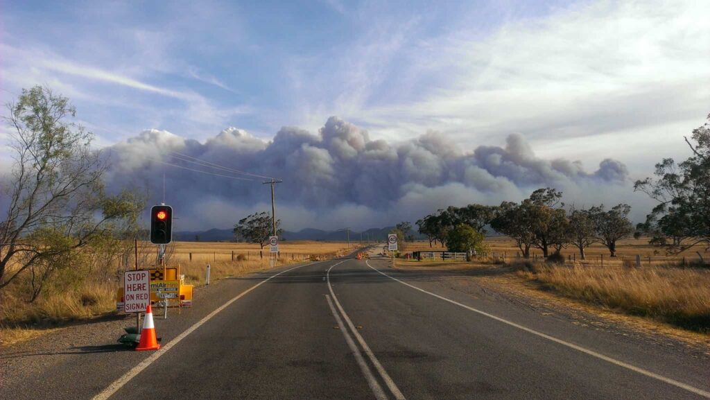
The start of the bushfire season for 2013 was a wake-up call for most Australians. Sydney was blanketed in smoke while 56,000 hectares of bushland in the Blue Mountains was reduced to ashes. More than 200 properties were destroyed and many more buildings were damaged.
So what role does a surveyor have in protecting a property from bush fire attack? Because surveyors are involved at the planning stages of development, they are able to design road networks, house lots and open space to minimise the danger to dwellings and lives from bush fire attack.
In new residential developments, consideration must be given to the bush fire status of the land. Council mapping generally indicates whether particular lots are affected by bush fire prone land, but this is not an exhaustive resource. Bush fire mapping is usually prepared based on aerial imagery and has historically been notoriously inaccurate. More recent models have refined the bushfire mapping to make it a more effective tool.
If a property is affected by bush fire prone land, in order to commence a subdivision, a Bush Fire Assessment Report must be prepared by a qualified consultant. A Bush Fire Assessment Report analyses the ground slope and vegetation in areas which may affect the proposed dwelling and provides an assessment of whether it is possible to provide an adequate Asset Protection Zone (APZ) and whether any dwelling constructed in the area will have to be built to a higher building standard to counter bushfire attack. Other items considered include access to and from the site, public road system capacity, water supply and electricity supply.
The first factor for a consultant to consider is the bush fire threat assessment. This is based on the bush fire mapping provided by the Local Council. If the mapping indicates that the site is affected by bush fire prone land, a full assessment is required. Bush fire threat levels are indicated as high or medium threat levels based on colour, with a buffer zone from the edge of the area indicated as bush fire prone. If the subject land is indicated as bush fire prone, or affected by a buffer zone, a Bush Fire Assessment Report is required for development which will result in new dwelling entitlements or construction.
Another important factor to consider is the Fire Weather Area. This is based on general climatic, vegetation and slope figures for Local Government Areas, and gives a Fire Danger Index rating for each area.
The Vegetation Classification of the land within 140 metres of any proposed dwelling will greatly affect the bush fire threat. Grassland will have a quite different effect on bush fire behaviour to open forest or rainforest.
The effective slope from any dwelling site is most significant for down slopes from the site. Fire burning uphill is much more dangerous, burns faster and hotter than fire burning downhill. In general terms this means that house sites on ridge tops are much more vulnerable to bush fire than house sites at the bottom of slopes.
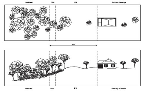
With consideration of the items above and other factors such as the intended use, access and water supply, an Asset Protection Zone (APZ) and setback to vegetation can be designed.
An APZ consists of two areas, an Inner Protection Area (IPA) and an Outer Protection Area (OPA). The OPA serves to reduce the potential length of the flames, filtering embers and reducing the likelihood of crown fire. The OPA should provide tree canopy cover of less than 30% and should have the understorey managed (mowed) to treat all shrubs and grasses on an annual basis in advance of the fire season. The IPA is critical and provides a defendable space and manages heat intensities at the building surface. The IPA should provide tree canopy cover of less than 15% and should be located greater than 2 metres from any part of the roofline of the dwelling. Garden beds of flammable shrubs are not to be located under trees and should be no closer than 10 metres from an exposed window or door. Trees should have lower limbs removed up to a height of 2 metres above the ground.

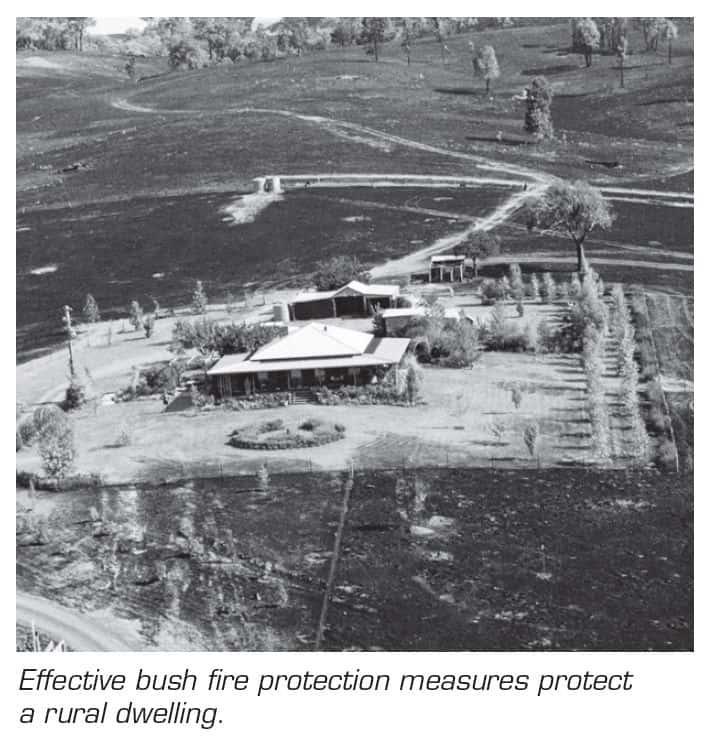
An example from the NSW RFS publication Planning For Bushfire Protection demonstrating the value of a correctly designed and maintained APZ.
If an adequate APZ is not able to be provided within the subject land, the level of construction of the dwelling will have to be increased.
Adequate Asset Protection Zones have been proven to save properties from bush fire attack, particularly when combined with appropriate maintenance such as mowing grass, lopping trees and clearing gutters of leaves. Even if you are not considering a new development, an APZ will save your property, and possibly your life!
Eric Smith
Registered Surveyor


