


Doherty Smith & Associates is now Compass Consulting Surveyors
Click here to see this blog and more on our new website compasscs.com.au
Since 1788, the rapidly growing colony of Australia utilised land surveyors. Land surveyors were assigned the task of delineating new land rights as settlers spread out from Sydney.
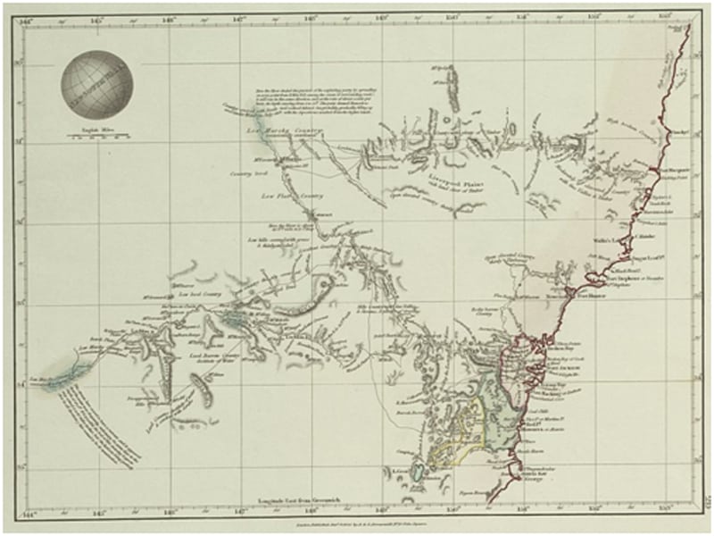
Early maps were prepared with the intention of showing the topography of the land to allow for planning of transport routes and potential settlement locations. Government surveyors were also given the task of excising allotments and portions of land from the Crown for private sale.
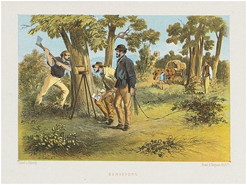
The initial surveys performed in NSW were, obviously, not of the same standard as surveys undertaken today. The equipment used was quite basic by today’s standard, consisting of a measuring chain and circumferentor – a compass-like device for measuring angles. There were no published standards for actual measuring and marking of boundaries which led to confusion and disputes.

In 1836, the Surveyor General issued two circulars setting out minimum standards for plan preparation, measurement methods and marking of boundary corners including placement of recovery or reference marks. In 1848, a new circular was released, instructing surveyor on measurement methods – “which are to be performed in the usual manner by taking angles with a theodolite, bearings with a circumferentor, and measurement of the lengths of the several boundary lines with a Gunter’s Chain”. The surveyors were instructed, wherever possible, to make boundary lines follow “cardinal points of the compass, with magnetic bearings”. Where it was not possible to follow such lines, the surveyors were instructed to show on the plan the reasons for any deviations such as streams, mountains, swamps or other natural features. The plans of this era are often quite beautiful with colour renderings of the landscape as well as the pertinent survey information.
In 1864, the first Regulations for the Guidance of Licensed Surveyors was issued by the Surveyor General. Amongst other items, the 1864 regulations set out a list of instruments to be provided by each Licensed Surveyor as follows:
- One Theodolite, not less than 4 inches in diameter
- One Circumferentor, not less than 4 inches in diameter
- One chain to be kept as a standard, and never used in survey
- Two or more chains for general use
In 1872, the use of a circumferentor was prohibited, and the accuracy of surveys generally increased as a result. Modern surveyors will occasionally encounter lines which have not been surveyed since they were first marked, and most will have experienced errors of a surprisingly large magnitude. Some plans dated prior to 1860 in the Wellington area have been found to have errors in the order of 1 metre in 100 metres. This kind of error is often the result of a worn chain in combination with the use of a circumferentor.
As time went on, technology improved, and in 1882 the list of instruments in the Regulations were amended:
- One Theodolite, not less than 5 inches in diameter
- Two Steel Ribands, 66 feet long; one to be used for adjusting and testing the riband and chain used for measurement.
- One Gunter’s Chain
- One metal parallel ruler, not less than 18 inches long
- One metal protractor, not less than 6 inches in diameter, or a cardboard protractor.
- One set of chain scales, and other necessary drawing instruments.
The steel riband was to linear measurement what the theodolite was to angular measurement. Accuracy of linear measurements increased, and the Gunter’s chain was soon to be removed from the list of standard equipment.
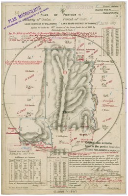
In 1886, the Regulations introduced a standard of accuracy to plans. “The accuracy of the survey of each portion should be determined by latitude and departure; and if the close is not within the following limits …” and then proceeded to provide minimum standards for level, undulating and mountainous terrain. Penalties were introduced for the destruction of survey marks, which is a problem still faced by surveyors today – and penalties for destruction of survey marks still exist!
By the early 1900’s, the standard of measurement was excellent. Angular accuracy was improving and the steel riband meant linear measurement was also good, with further improvement from the adoption of the invar band around 1914.
The theodolite and band combination was used until the introduction of electronic distance measurement in the 1970’s. Even then, due to the size and expense of this equipment, bands were used in decreasing numbers through the 1980’s. Most surveyors today no longer carry a band, relying on electronic distance measurement exclusively.
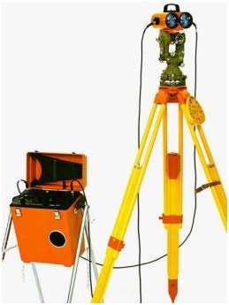
Optical Theodolite with top-mount Distomat Electronic Distance Measuring device.
Since the 1970’s, electronic distance measuring equipment has become smaller, faster, integrated with the theodolite and combined with computer controllers. Modern total stations are motorised, automatically track targets, contain sophisticated on-board software and increase the capability of surveyors. The use of GPS for surveying has enabled measurement over longer distances with centimetre accuracy.

Leica Smartstation with combined GPS and total station technology.
Coupled with the improvement in measuring equipment, the introduction of computers has massively increased the computing power of surveyors. Modern surveying and drafting software allows a surveyor to perform complex calculations and design work and present a clear, understandable and readable plan to their clients. The standards for registered survey plans have gradually increased over the years and appear set to increase further with the introduction of a new Surveying Regulation in 2012.
It is on this history that the future of surveying will be built. New measurement methods and equipment will be developed. By staying on the cutting edge of software and hardware, surveyors will able to provide more information to clients and present it in new ways. That’s surveying – use the efforts of the past to build a new future!