

Doherty Smith & Associates is now Compass Consulting Surveyors
Click here to see this blog and more on our new website compasscs.com.au
We have all seen a “trig station”, whether we are aware of the history and background of the marks or not. Located on landmarks such as hills or high man-made structures such as buildings or grain silos, these marks are rapidly becoming less relevant to surveyors today. Why are they there? What are they for? And how were they used?
Early explorers, who were almost by default surveyors in definition if not in title, fixed their position by observations to the sun and stars and related this to visible landmarks such as prominent hills, rivers or settlements. As the colonies in Australia expanded, so did the requirement for accurate maps. In order to link the small-scale surveys together, a control network was required.
The process of triangulation was used as the method to provide the locations of the trig stations, which were then used to connect to smaller scale surveys or for mapping. The word “trig” is short for trigonometric. A baseline between two or more trig stations was measured and by intersecting angles, the positions of trigs observed from the baseline trigs could be determined. This process was repeated and the network expanded. For this reason, most trigs are located in points where they are visible and where it is possible to observe to other trigs.
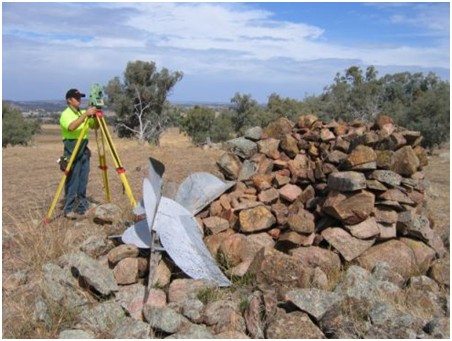
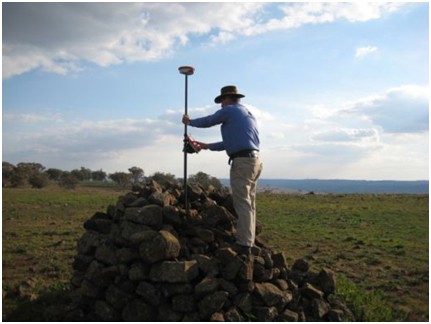
Early trig stations consisted of a brass plug fixed in concrete with a large cairn of rocks erected over it, and a pillar with metal vanes standing upright over the mark. These marks were prone to destruction by lightning, fire or simply neglect and the passing of time. In addition, to access the brass plug required dismantling the cairn and reassembling afterwards. With these limitations in mind, the concrete pillar version was devised.
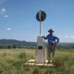
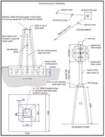
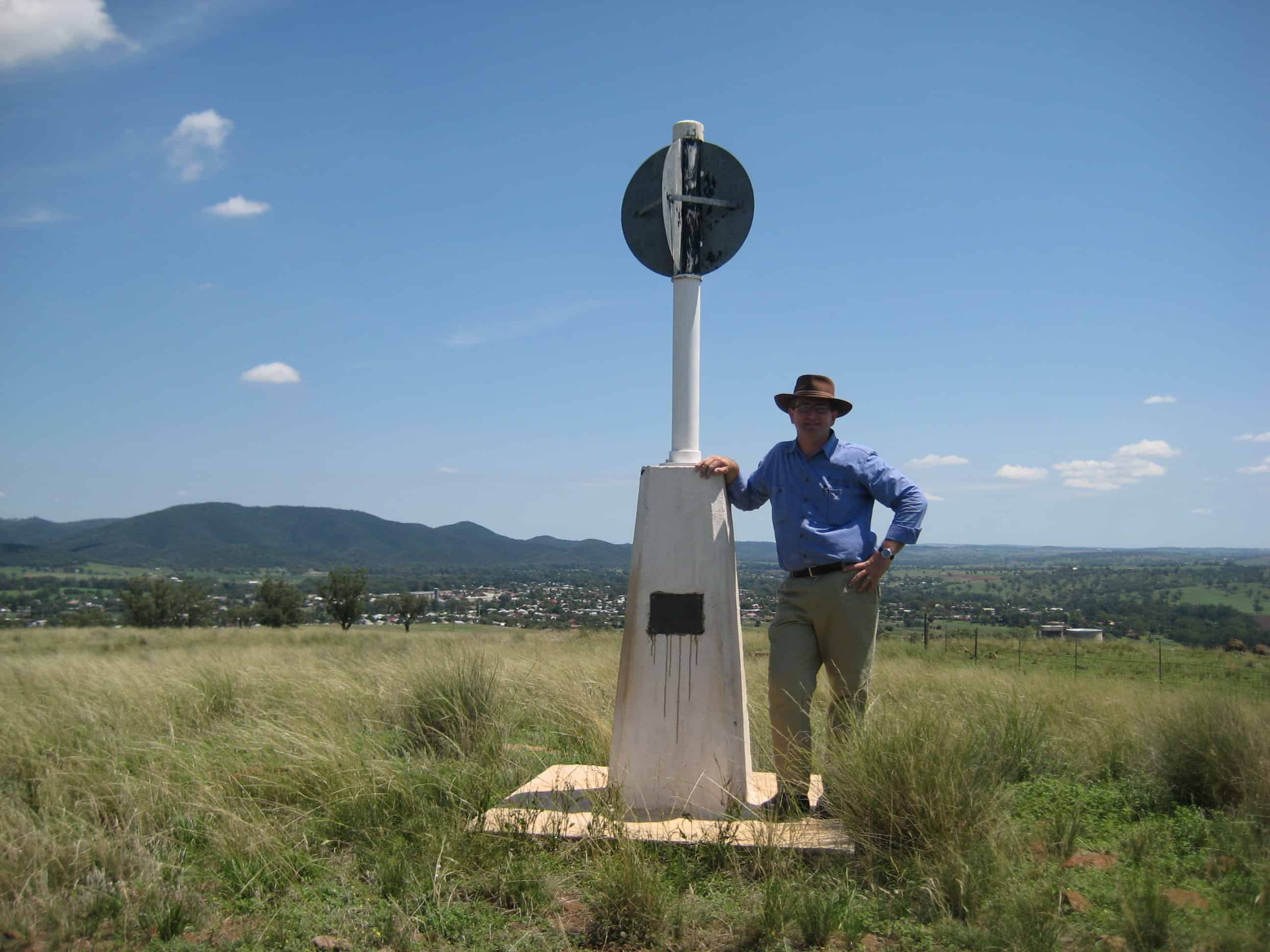
The concrete pillar trig station has a solid concrete foundation and a pillar 1.3 metres high, with a vane on top which can be removed by surveyors to access a threaded spigot on top to mount survey equipment.
Another current version of a trig station is a rooftop pillar, which can be seen mounted to manmade structures such as buildings and grain silos.
In today’s era of Global Navigational Satellite Systems (GNSS) and Continuously Operating Reference Station (CORS) networks, trig stations are becoming less relevant to surveyors. In addition, the upkeep required on the trig stations in NSW has proven to be unmanageable for the Government Department responsible and many older trigs are in disrepair or ruin, while the newer concrete trigs are often completely blocked from view by vegetation.
When surveying in rural areas, Doherty Smith & Associates often have cause to use a trig station, although generally this is to re-establish the boundaries rather than for any other purpose.
So when exploring our lesser known parts of the state, keep your eye out for the trig stations. While enjoying the view, consider why it was put there and what it is used for today.
Eric Smith
Registered Surveyor