Doherty Smith & Associates is now Compass Consulting Surveyors
Click here to see this blog and more on our new website compasscs.com.au
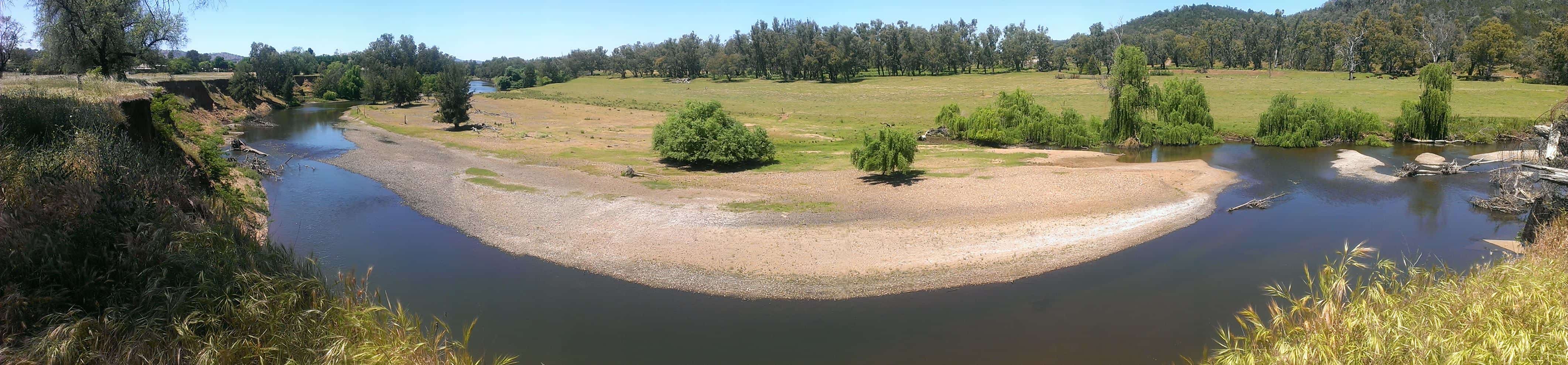
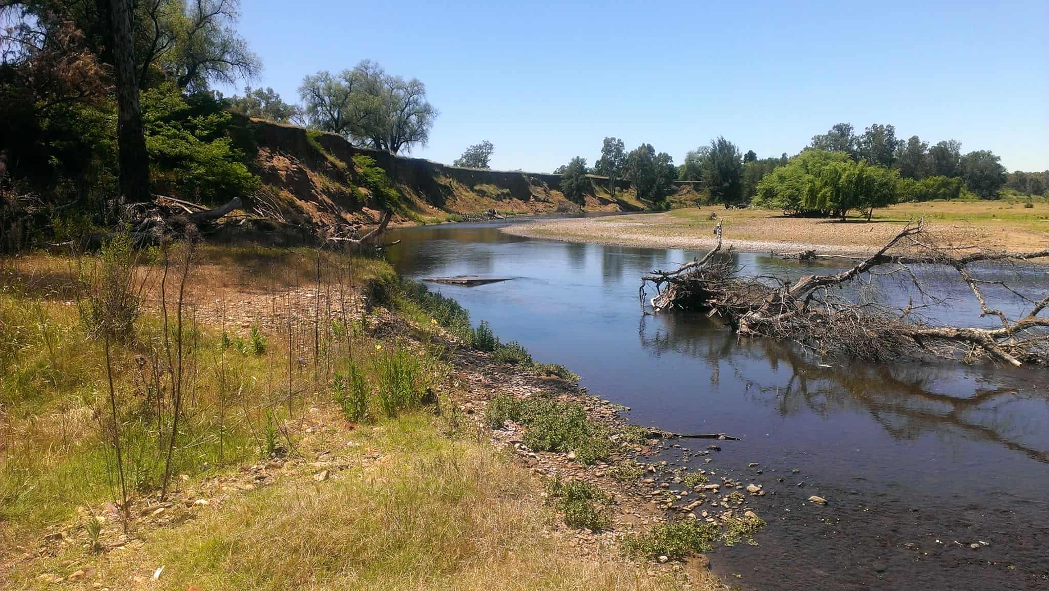
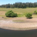
The Macquarie River at Wellington
River and creek boundaries (non-tidal streams) are considered to be “Ambulatory” – the literal meaning of which is “relating to or adapted for walking”. This term serves a purpose, but the actual changes to the course of a river or creek are more appropriately described as “serpentine”. While we tend to accept that the banks of a stream may change a little over time, major and noticeable changes also occur – and tend to cause major problems when they do!
Land which has a boundary defined by the bank of a non-tidal stream, such as the Bell or Macquarie Rivers, is subject to the “doctrine of accretion and erosion”. This legal term states that where there is an acquisition of land from the sea or its inlets or from a stream, by gradual and imperceptible means, the accretion is held to become part of the adjoining land so as to be included in the title. Any erosion which may occur by gradual and imperceptible means is also deemed to change the boundary of the land.
What happens, however, when a stream changes course suddenly, noticeably and in one or more flood events? In such cases, the boundary “ceases to be ambulate” and the boundary remains in the position it was in immediately before the change or changes occurred.
“Gradual and imperceptible”?
The doctrine of accretion and erosion has been the subject of many court cases, most of which enter in to detailed debate and commentary on what is gradual and imperceptible accretion and erosion. In most cases, imperceptible has been taken to mean not noticeable from day to day, which may mean that the changes occurred in a series of perceptible events. Changes to the course of a stream following this definition will be detectable over a long period of time, while not necessarily apparent on a daily basis.

Since 1964 the Bell River at Wellington and the Macquarie River adjacent to the confluence of the Bell have changed dramatically. The changes to the Bell River are most obvious from a point where Maxwell Street meets the river. At this point, the river has changed course by approximately 80 metres.
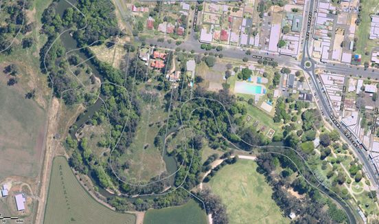
Following the river downstream as it flows northward, large changes to the river course can be seen to the south of Warne Street, again with changes of about 80 metres.
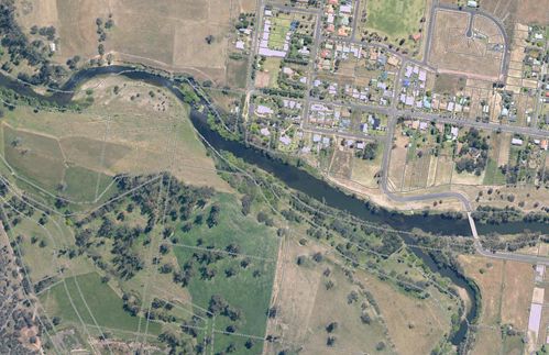
This trend continues as the Bell flows northwards and eventually meets the Macquarie. In years past, the Bell used to flow roughly parallel to the Macquarie for about 600 metres. At some point, the Bell burst its banks and cut a new channel through to the Macquarie, cutting off this 600 metre section of the old Bell course.
At a point roughly opposite where the old Bell met the Macquarie, the northern bank of the Macquarie has been substantially eroded. Estimates based on a survey dated 1878 compared to the current river bank location give a change in the bank of almost 140 metres. In one location at least one old dwelling has been lost to erosion and at present, large blocks of earth are dropping in to the river daily. Needless to say, this change is unlikely to be considered either gradual or imperceptible!
So what rights do landowners have when faced with substantial sudden changes to the bank of a non-tidal stream? Unfortunately, non-tidal streams fall under the jurisdiction of many different government departments and other organisations. Catchment Management Authority, Office of Water, Fisheries, Local Government, Landcare and more. An owner may apply to the Valuer General’s department to have the valuation of their land reassessed if a river has changed its course, which should reduce the Council rates payable. Any proposed physical changes to a river bed or bank must be accompanied by a comprehensive plan prepared by a suitably qualified professional, setting out the scope and extent of any works, time frame, what the proposed works involve, how it will be done and who will be doing the work. As a minimum, the Office of Water must approve the works, however this may require joint approval by other departments or organisations. Land and Property Information NSW will accept a deposited plan of survey showing the bank in a new location if the plan is accompanied by a comprehensive report by the surveyor which will leave the land reduced in size and the physical bed of the river as Crown Land.
It would appear from the changes demonstrated above that the Bell and Macquarie Rivers are much more “ambulatory” than assumed by the early settlers. Alternatively, there is a massive, systematic problem being caused or exacerbated by the stormwater drainage of Wellington entering the Bell River. Possibly, the answer is a combination of both options. Unfortunately for the owners of the land affected by the changes, the only solution is a long term stabilisation of the existing banks and an attempt to prevent further changes.