

Doherty Smith & Associates is now Compass Consulting Surveyors
Click here to see this blog and more on our new website compasscs.com.au
When marking a boundary for a registered plan, a surveyor must place “Reference Marks” which are located away from the actual boundary corner, with a stated bearing and distance to the boundary corner. Under the current Surveying and Spatial Information Regulations 2012 (Schedule 4), reference marks can include a permanent survey mark, Drill Hole and Wing in rock, concrete or substantial structure, Chiselled Wing cut in fixed timber or sound wood of a suitable tree, Broad Arrow cut in rock, concrete, substantial structure, fixed timber or sound wood of a suitable tree, a Metal Spike or galvanised iron pipe at least 300mm long placed vertically and at least 80mm beneath the surface of the ground and many other marks.
Early surveys in NSW were more limited in the choice of marks they were able to use. Until July 1886, surveyors were only able to use trees as reference marks to boundary corners. After July 1886 surveyors were able to use “permanent marks” which were either a glass bottle, gas pipe or iron bolt (for homestead surveys only) and the use of special marks of this nature as reference marks was not introduced until 1895.
Today, reference trees are becoming rarer to discover, particularly in areas subject to cultivation. In more mountainous terrain, the likelihood of finding a reference tree still standing is slightly higher. Unfortunately, where the chance of human interference is less, the quality of tree is generally lower, so finding reference trees in mountainous terrain is not a sure thing.
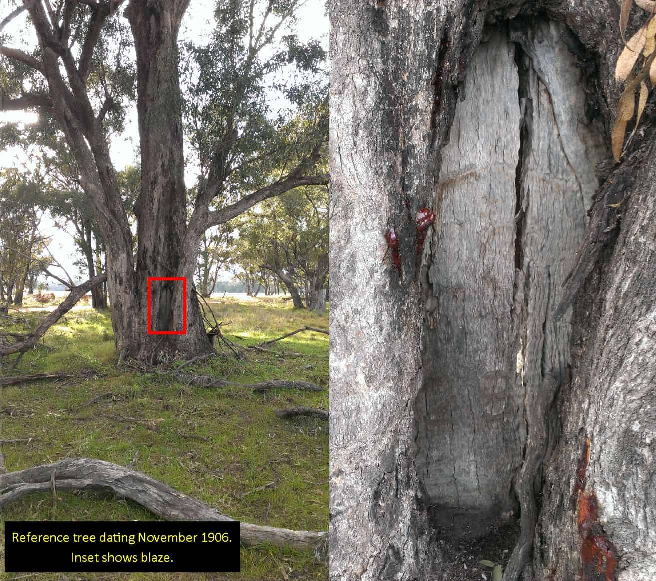
The tree shown above is located on the banks of the Little River and was first marked in the early 1900’s. This tree is an excellent example of a reference tree. The blaze was cut using an axe, exposing the solid wood of the trunk, then a broad arrow was added with the numbers of the portions (allotments of land) adjacent to the corner below.
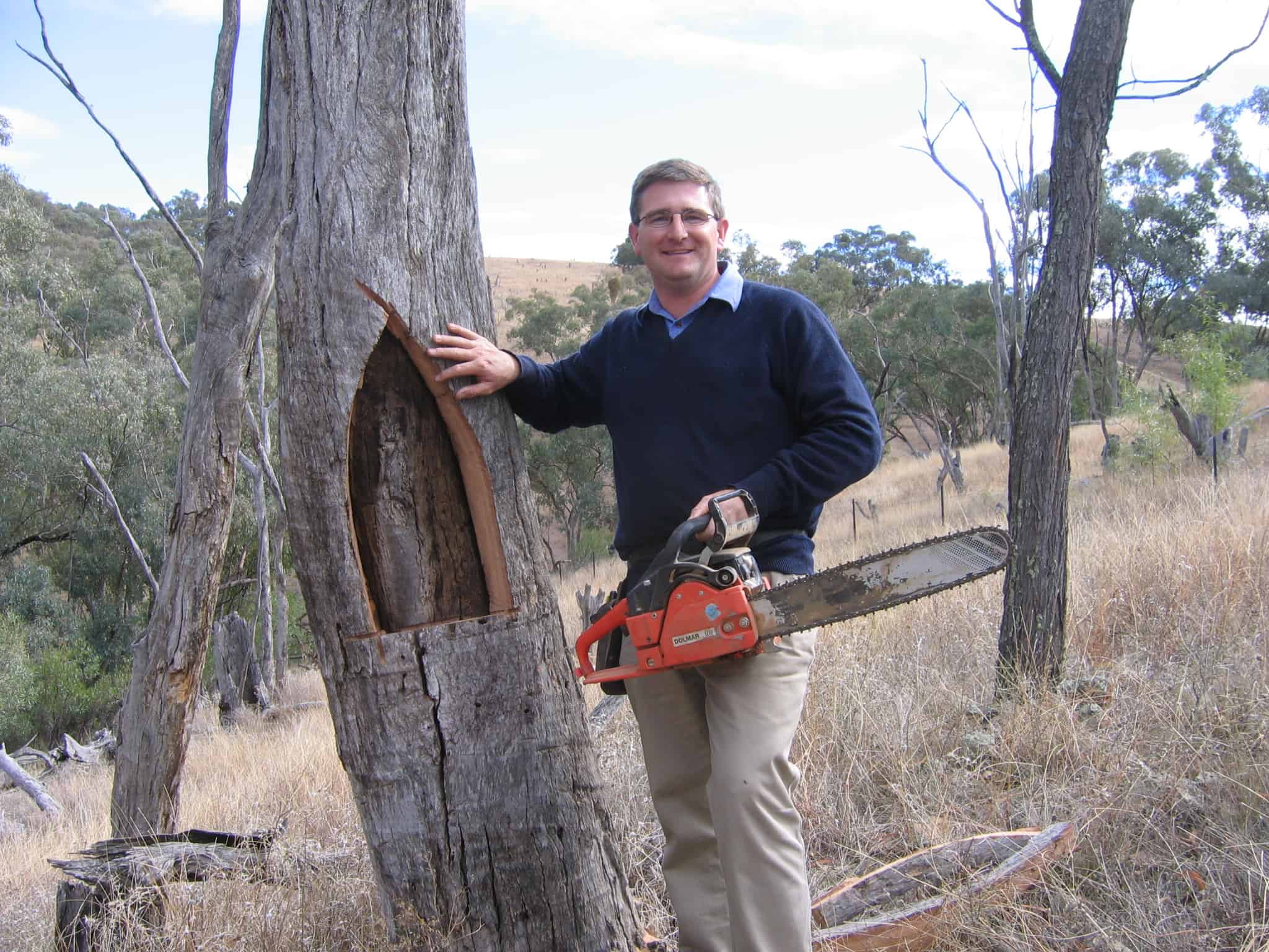
The dead box tree above was found in fairly mountainous terrain, with the blaze partially obscured by the tree growing over it. The blaze was exposed using a chainsaw. Re-exposing a blaze which has grown over has potential to kill a living tree, so standard practice for Doherty Smith & Associates is to avoid this whenever possible.
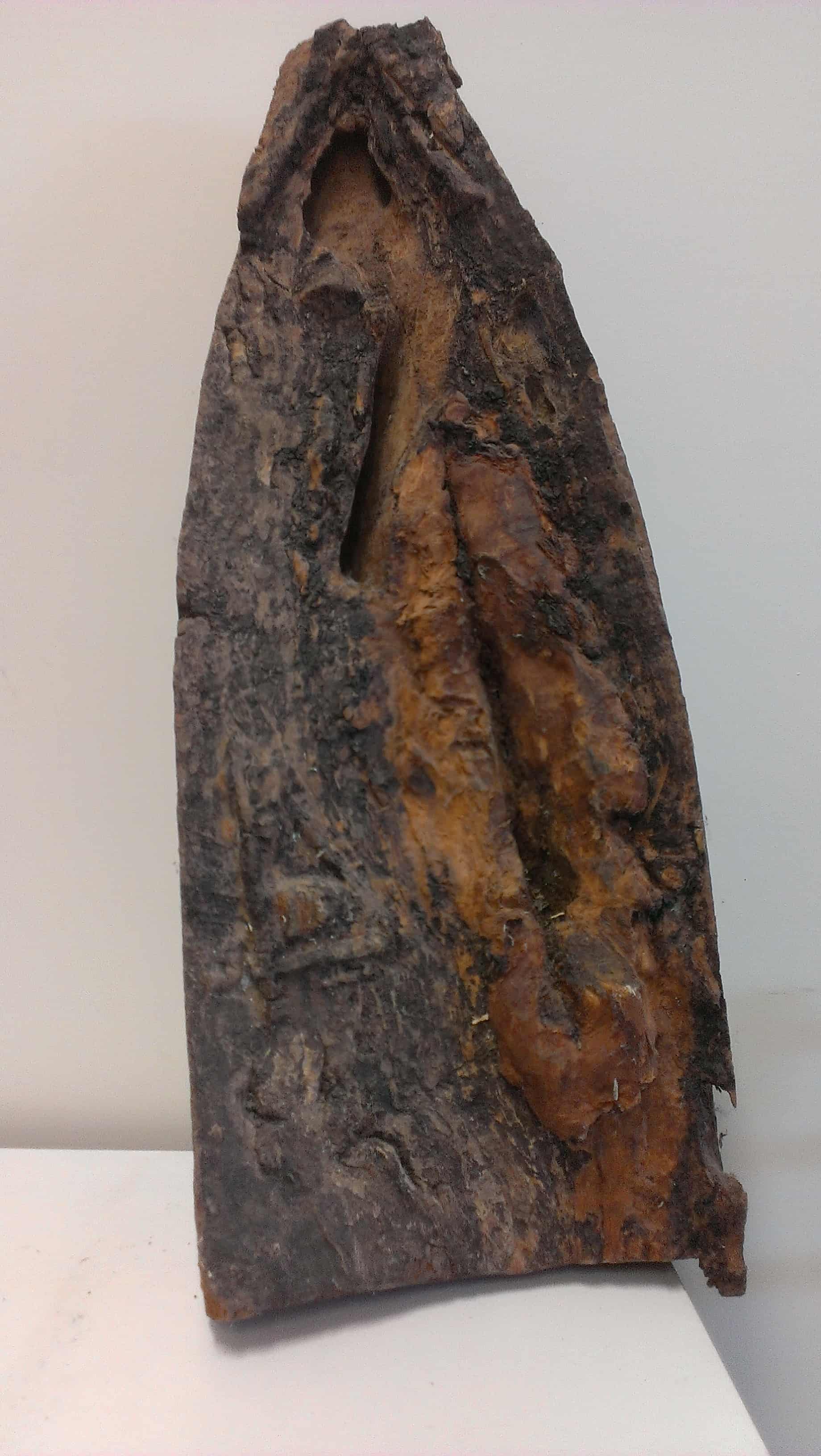
The box tree above is located in very steep and heavily timbered terrain. The blaze, placed in the late 1800’s, had not grown over, however the face of the blaze was affected by termite activity.

Located in the far north-west of NSW, this tree, dating to the late 1800’s, shows a fairly clear blaze although the tree itself is dead. The dry climate in these regions means a dead tree may stand for decades before falling.
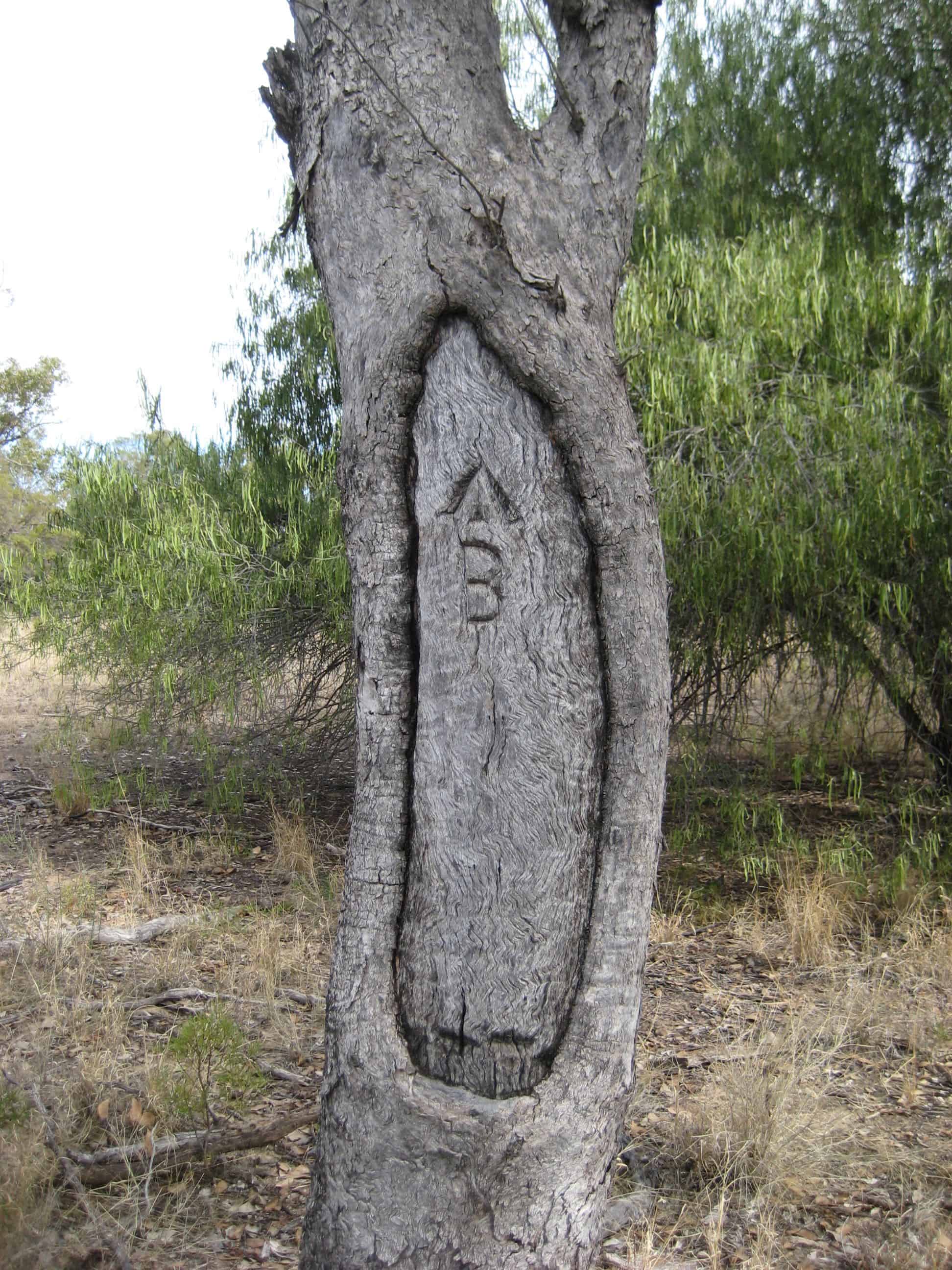
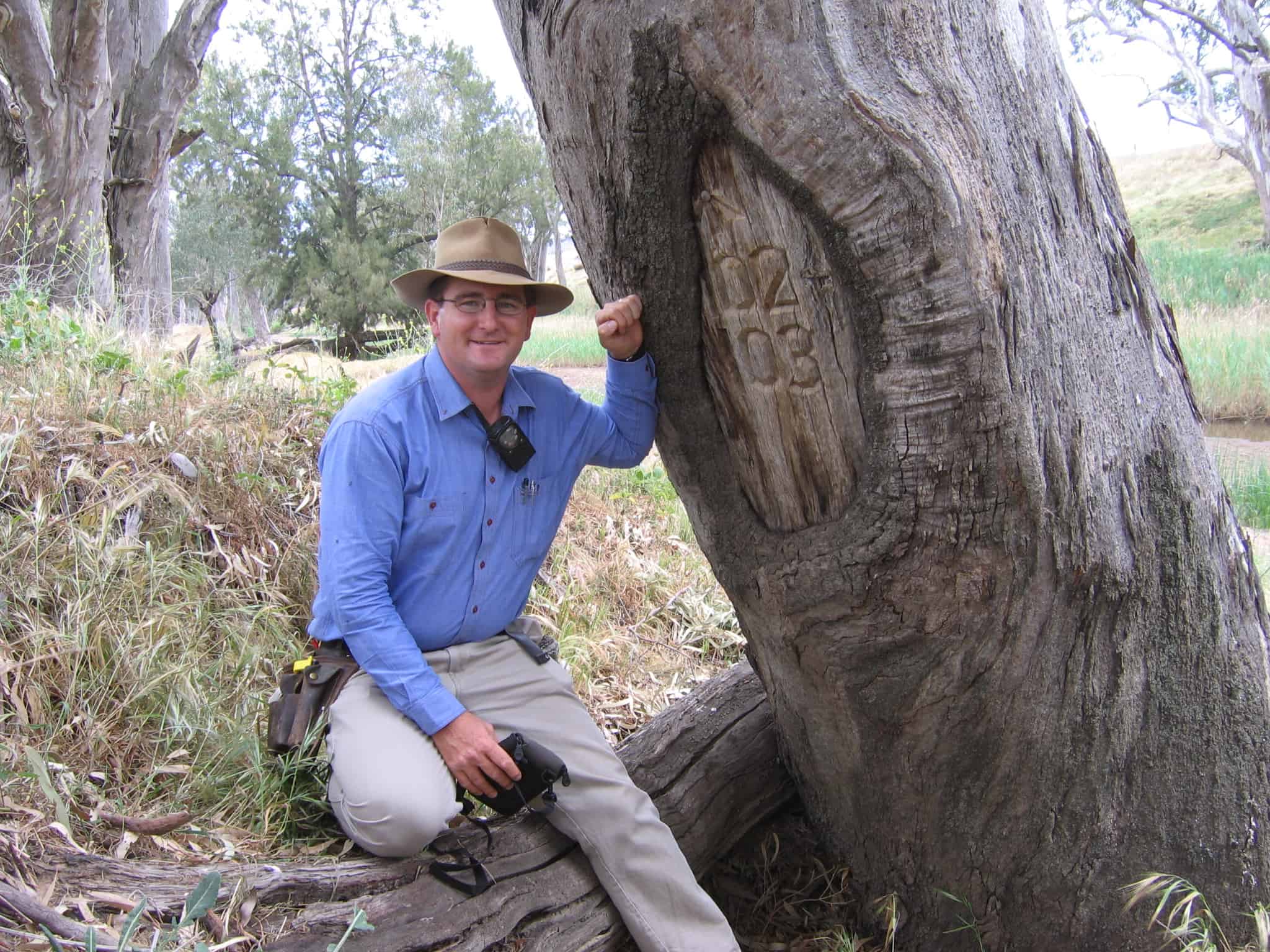
The reference tree above is also located in the far north-west of NSW and is shown on a plan as a reference to corner ‘B’.
The blazed tree shown in the picture above is actually a line tree. When marking unfenced boundaries, trees on the line of the boundary were blazed with double blazes. When fences are erected on boundaries, these line trees are often removed, making a blazed line tree quite rare.
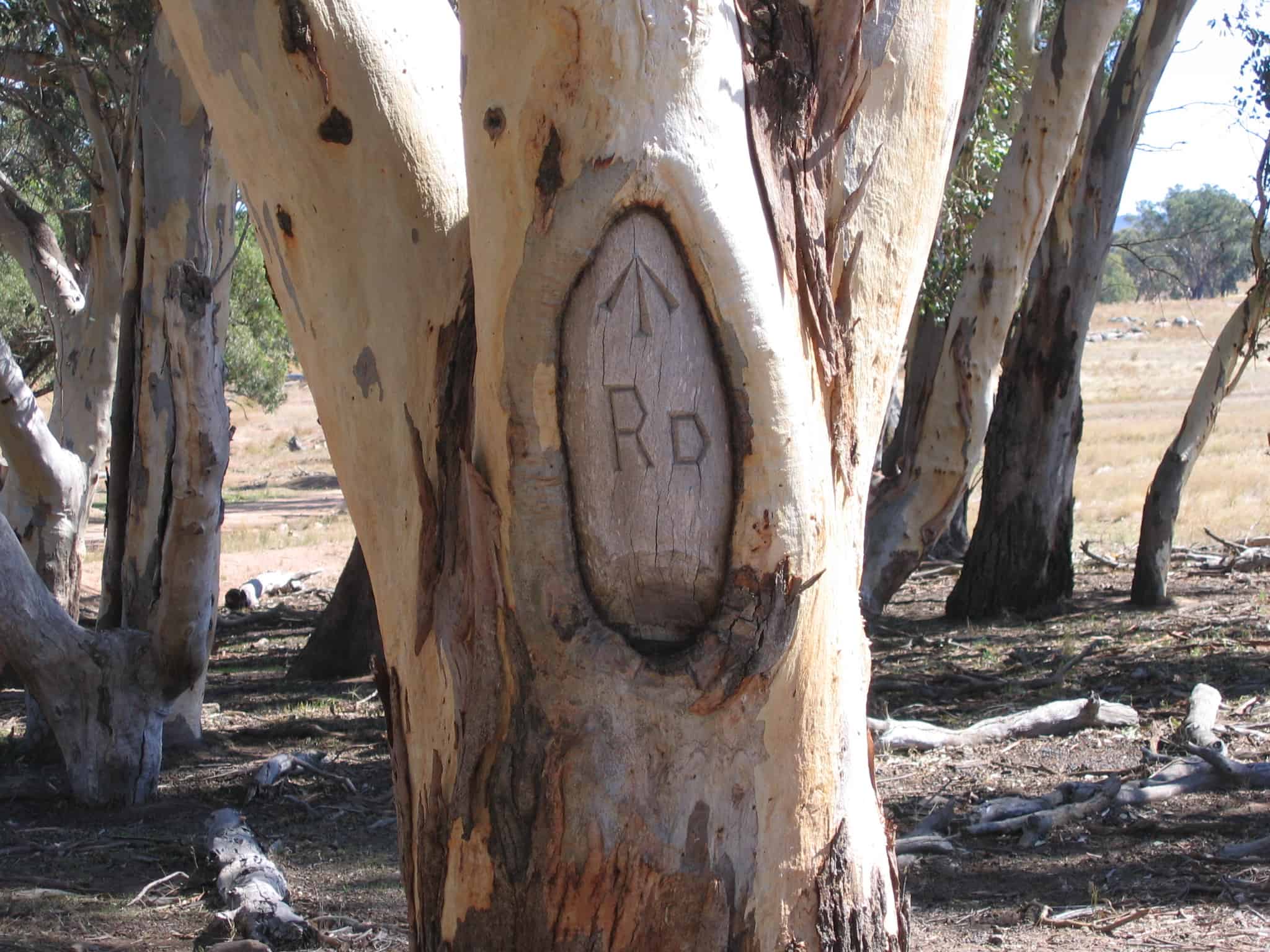
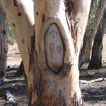
The tree above was placed in a relatively modern survey from the early 1980’s and shows a clear broad arrow. The RD on the blaze refers to a road, which was the reason for the survey.
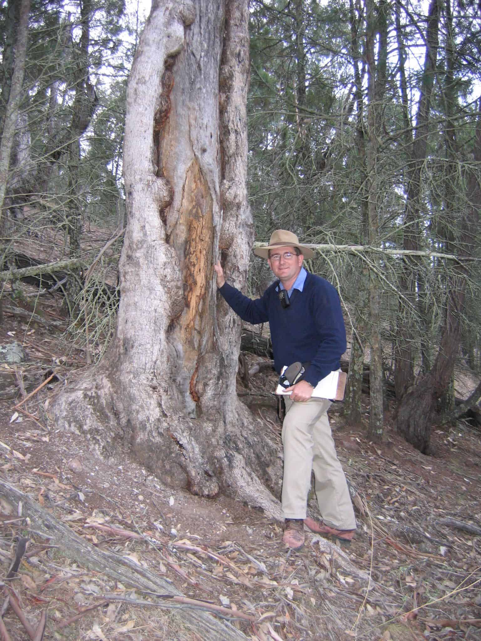
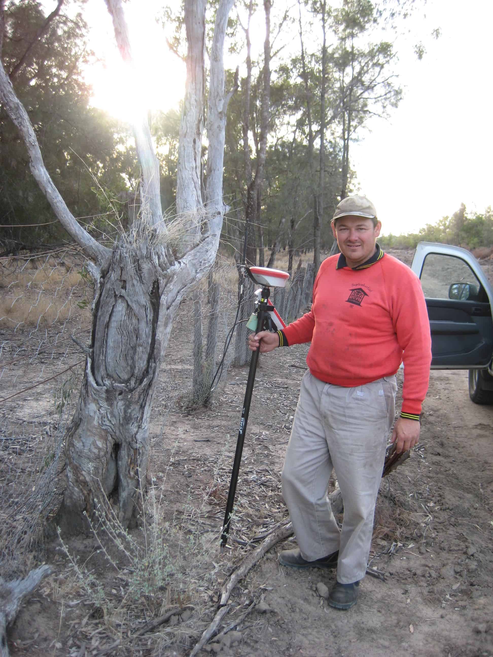
The tree above is a good example of a blaze which has grown over. Rather than expose the entire blaze in the living tree, a small window was cut and drilled to determine the depth to the blaze, with the location of the broad arrow estimated to be the centre of the fold (or “bum”) on the trunk of the tree.
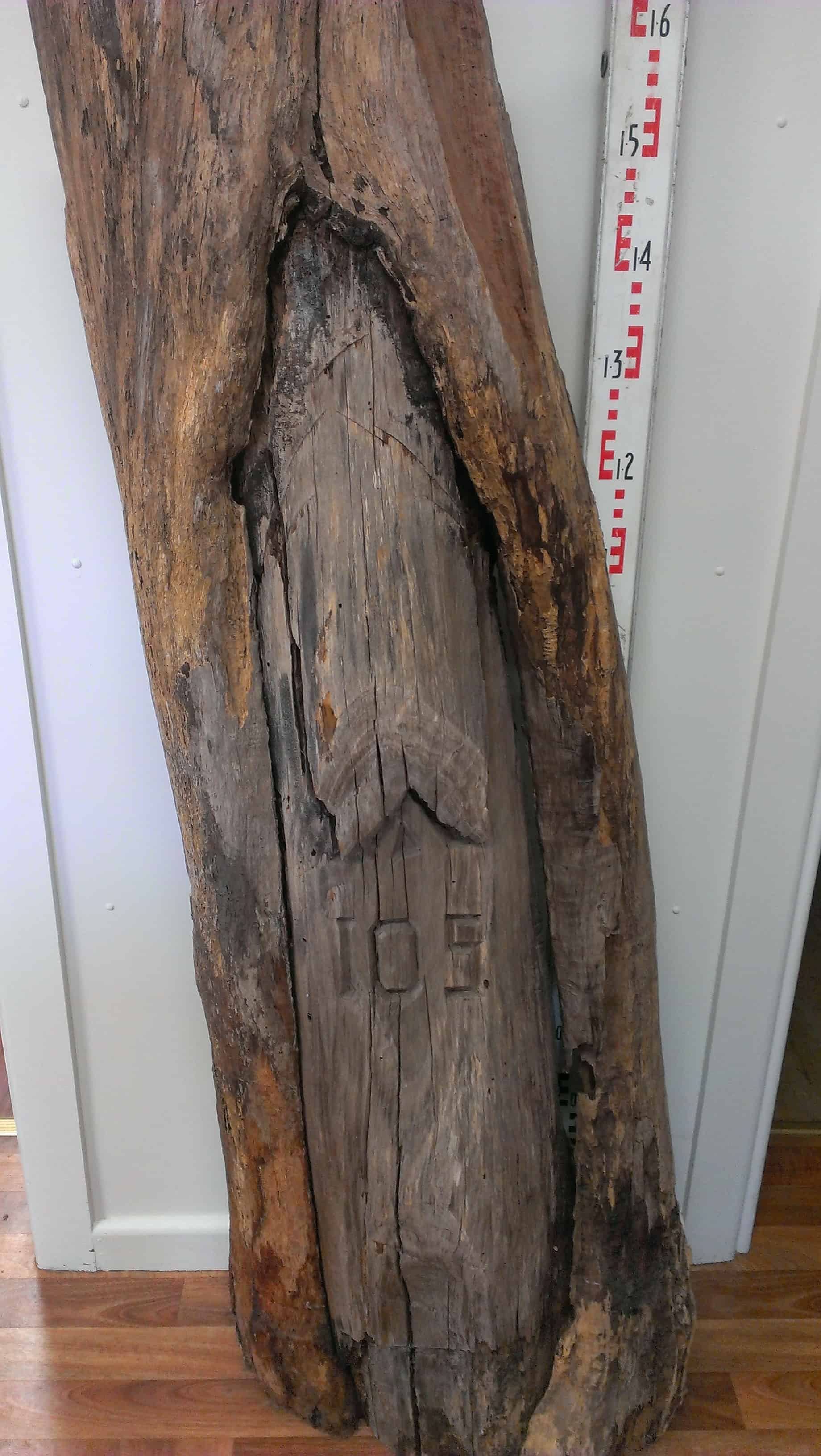
The box tree above was first blazed in 1906. The blaze had not overgrown and is clearly legible today. The broad arrow on this tree takes a strange elongated form, with readable portion numbers below.
Taking pride of place in the Wellington office of Doherty Smith & Associates, the tree above was discovered near Nundle in very mountainous terrain. The tree had fallen and was found pushed into a heap of firewood to be burned. The stringybark tree was blazed in the 1950’s and is an excellent example of a reference tree.
When a blaze grows over and is re-exposed, occasionally a reverse imprint of the broad arrow and portion numbers can be seen. This blaze was removed from a living box tree in 1996, exposing a blaze dating from 1916. The broad arrow can be seen at the very top of the blaze, while the reverse number 4 can be seen on the face of the blaze.
The romance of dealing with old surveys and trees is something that most rural surveyors enjoy.
Eric Smith
Registered Surveyor