


Doherty Smith & Associates is now Compass Consulting Surveyors
Click here to see this blog and more on our new website compasscs.com.au
10 metre rule? 20 metre rule? Who owns a river bank in NSW?
There are many urban legends, myths, rumours, claims and stories claiming that there is a 10 metre rule or 20 metre rule giving public access along river banks, even where the adjoining land is privately owned. As explained in my blog Water as a Boundary – Non-Tidal Waters, non-tidal water boundaries in NSW are defined by certain terms:
Bank, the limit of the bed of the lake or river
bed, in relation to a lake or stream, includes any portion of the lake or stream:
(a) that is alternately covered and left bare with an increase or diminution in the supply of water, and
(b) that is adequate to contain the lake or stream at its average or mean stage without reference to extraordinary freshets in time of flood or to extreme droughts.
stream includes any non-tidal waters that are not a lake.
Source: Surveying and Spatial Information Regulation, Division 5.
Part of the difficulty in defining the bed of a stream relates to the definition of average flow of the stream, without reference to extraordinary freshet or drought.
What is a freshet? In this context, a freshet is considered to be a sudden overflow of a stream resulting from a heavy rain or flood – in short, a flood.
What is a drought? A drought refers to periods of no or low rainfall, no or low runoff which corresponds to no or low stream flow.
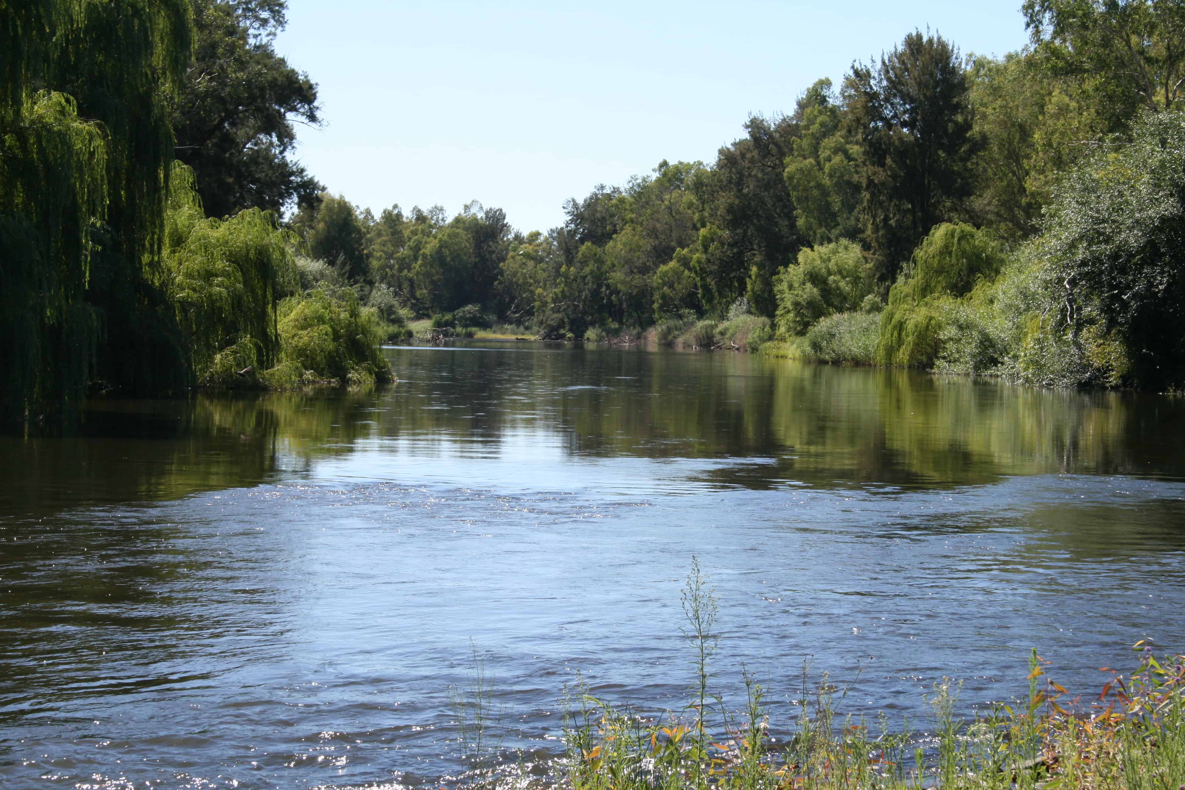
The bank of the stream is the limit of the bed of the stream. Where a stream contains water during its average flow, the bank will usually be considered to be the edge of the water at average flow. Where a stream only flows intermittently, the edge of the bed will usually be the limit of the shingle beds, sandy banks, or other features inundated by the flow of water without referring to a flood event. If in doubt, a surveyor should be engaged to determine the location of the bank of a stream.
The source of the supposed 10 metre rule, or 20 metre rule, appears to be based on reserves in the state of Victoria, where in some cases a reserve of 50 or 100 links (10.058 or 20.116 metres respectively) exist along a river bank. Note that 10.058 can be rounded to 10.06 metres and 20.116 can be rounded to 20.12 metres, just to enhance the opportunity for confusion! The reserves along river banks in Victoria include Public Purposes Reserves which are set at a fixed width from the bank of the river at the date of survey when they were created. For more information in relation to the reserves in Victoria, see River Boundary Determination by Peter S Knights, here.
In NSW, however, the adjoining owner owns to the bank or centre thread of the stream unless a reserve exists. There is no express or implied rule giving access along a river bank through private land. Where a reserve does exist, it exists as a separate lot, as shown below:
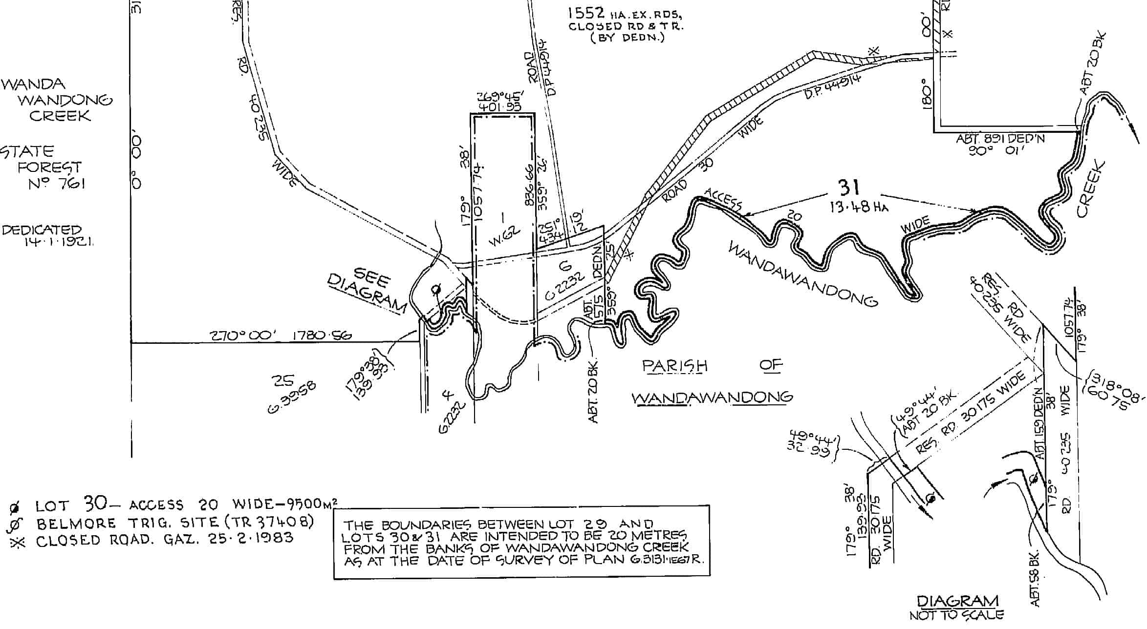
This plan created a reserve, 20 metres wide, along the bank of Wandawandong Creek, which is shown as Lot 31. Such reserves are not common in NSW. Unless such a reserve exists, the general public have no express or implied right to access the bank of the stream through private land without the permission of the land owner.
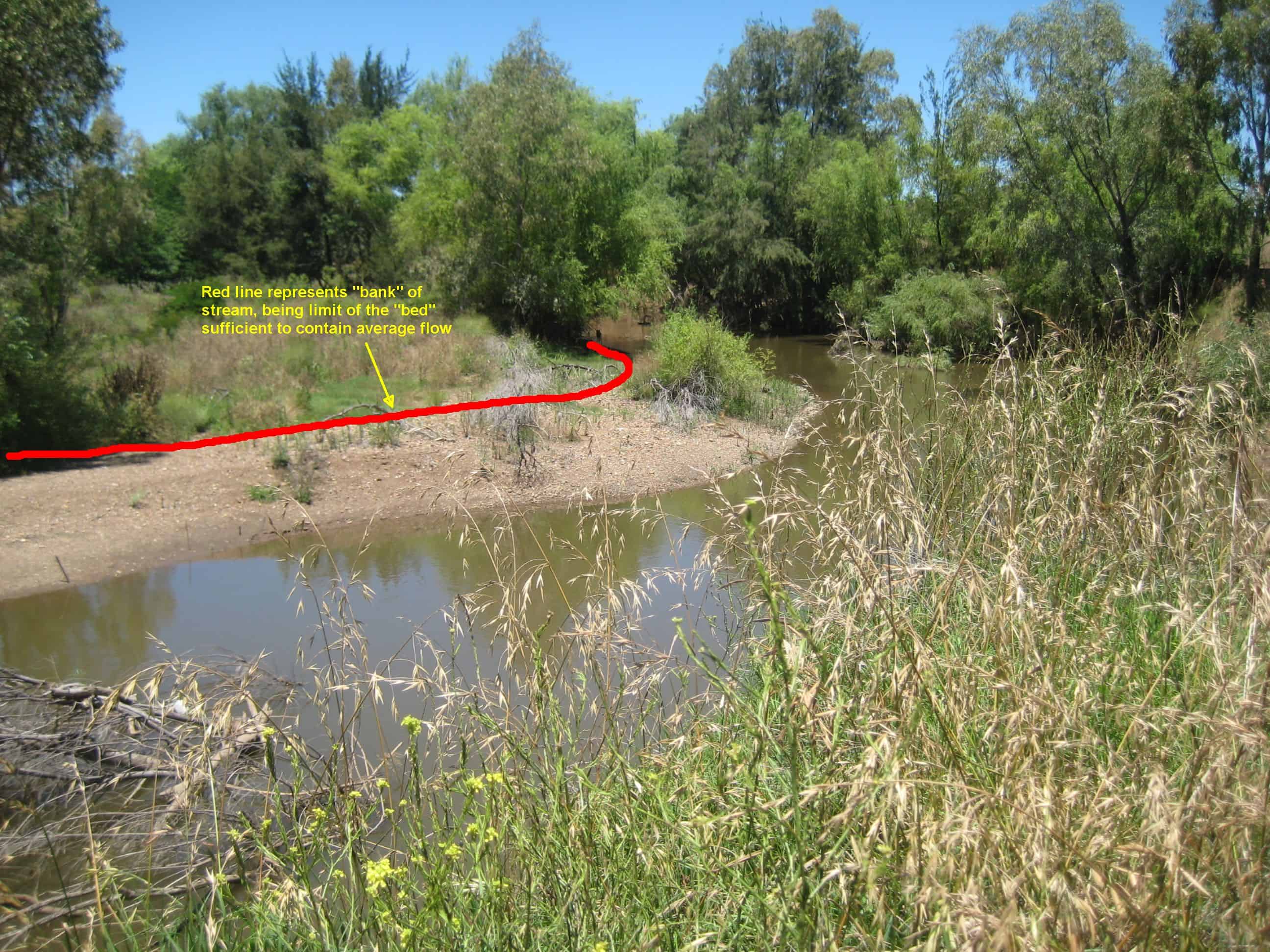
In the picture above, the red line represents the bank of the stream, as it contains the average flow of the stream.
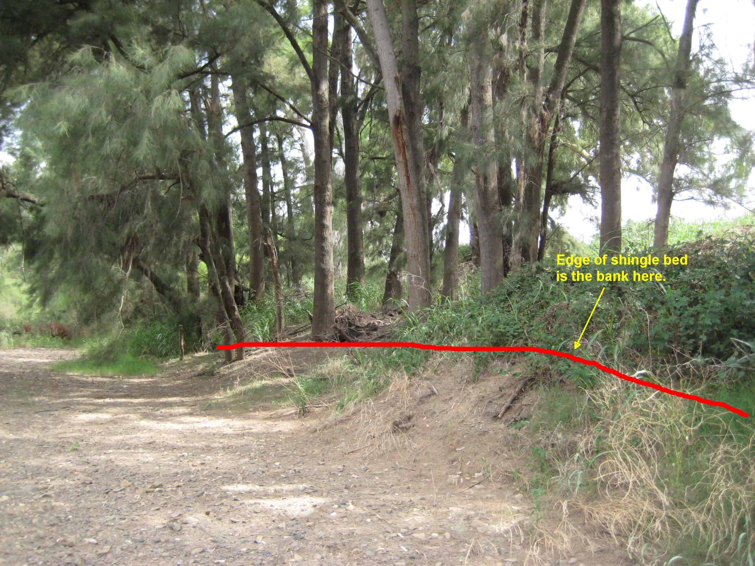
In the picture above, the red line represents the bank of the stream, being the edge of the shingle bed, which contains the average flow of the stream.
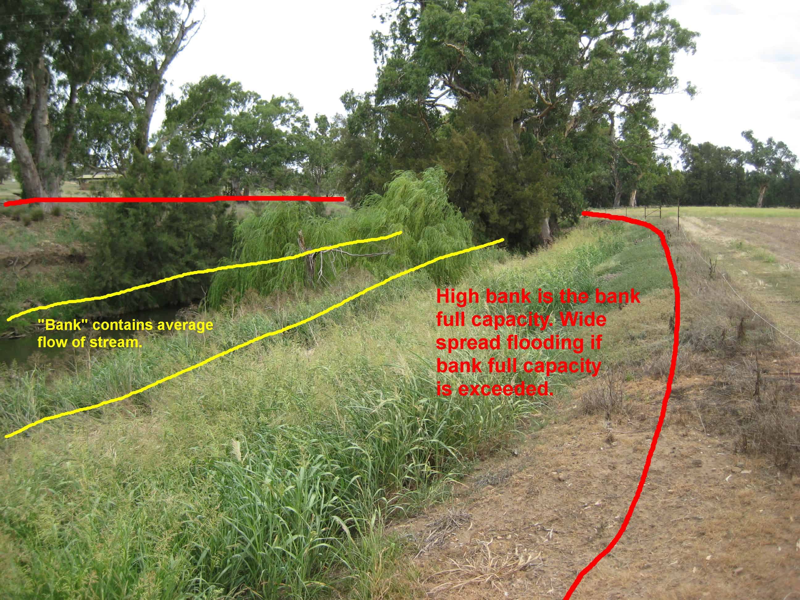
Where a stream has high and low banks, generally the high bank represents the bank full capacity of the stream during a flood event. If the high bank is overtopped, the result is usually wide spread flooding. The land owner owns to the low bank, with no implied or other right or reserve for access. Thanks go to Mr Les Gardner from Land and Property Information NSW for his advice in regard to the definition of banks above.
In places, the adjoining land owns to the centre thread of the stream. This is known as “Ad Medium Filum Aquae”, or “to the centre thread of the stream”.
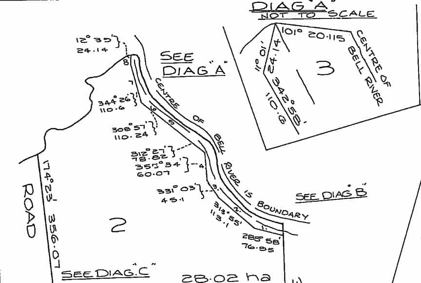
As shown on the diagram above, the boundary in certain cases is the centre of the stream, not the bank.
How can you find out if a stream has a reserve adjacent to it? An easy and quick way to check is to use the NSW Land and Property Information SIX viewer. The SIX viewer is similar to Google Earth or Google Maps, however is set up to show land boundaries and other information. To turn on land boundaries in the SIX viewer, click on the Map Contents button at the top-right of the screen. Tick the boxes for Lot Boundaries and Lot Labels. You may have to be zoomed in for all information to show. If in doubt, ask a registered surveyor.
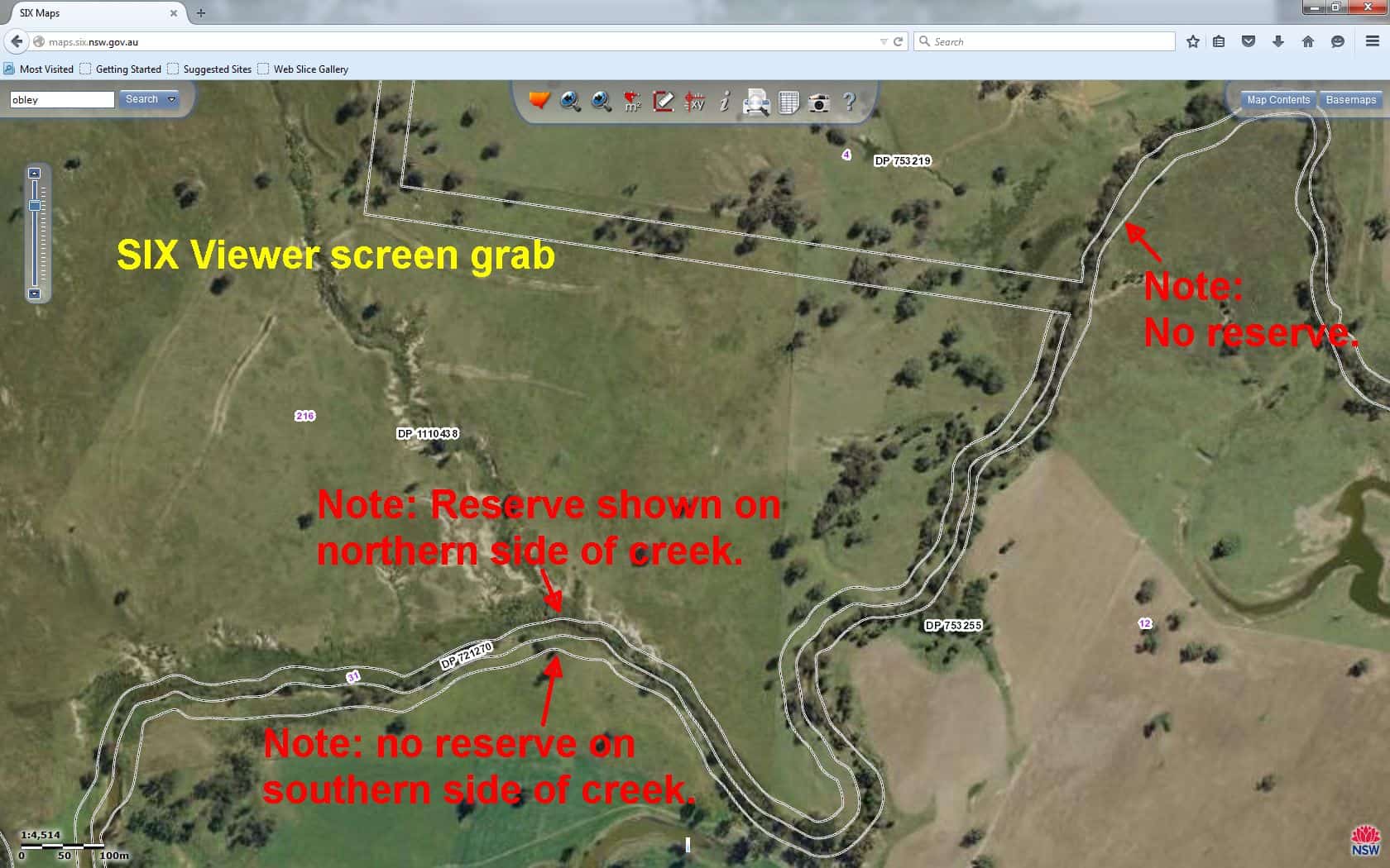
The screen grab from the SIX viewer above shows a creek with a reserve, however the reserve only exists on the northern side of the creek and does not exist on adjacent lots.
So, is there a 10 metre rule in NSW? Is there a 20 metre rule in NSW? No, generally the land owner adjacent to the stream owns to the bank of the stream as defined above, in rarer cases to the centre of the stream and occasionally a specific reserve does exist.
Eric Smith
Registered Surveyor