

Doherty Smith & Associates is now Compass Consulting Surveyors
Click here to see this blog and more on our new website compasscs.com.au
LiDAR is a method of measuring distance using laser light. The light reflected from the measured surface is analysed and the data stored as a cloud of points. LiDAR data can be captured by static ground observations using a scanning instrument or from a moving platform such as a ground-based vehicle or an aeroplane. Increasingly, the use of LiDAR in surveying is enabling large scale projects to be completed with high accuracy and significant cost savings.
NSW Land and Property Information are currently running programs to capture the topography of centres with population in excess of 400. LPI currently use a Leica ALS50 Airborne Laser Scanner to capture digital elevation data across NSW. The data is available for purchase in “tiles” which each cover approximately 2 square kilometres. The density of points measured is quite high, averaging at one ground measurement per square metre. The data has been linked to ground based control points and allows users to produce an accurate terrain model of a site without the need for ground survey.
Doherty Smith & Associates have used LiDAR data for several projects, including a rehabilitation project on the Macquarie River at Wellington, a proposed water treatment plant site at Parkes and a subdivision site at Dubbo. We consider the investment in this data worthwhile and an easy way to generate a terrain model for preliminary site planning and historical comparison. For example, LiDAR data at the Macquarie River site at Wellington has been used to determine the amount of change to the river bank since the site was scanned. It is hoped that an arrangement will be made between Land and Property Information NSW and other government departments to have a regular scan of this site, to monitor the change to the river. In terms of planning, the broad area captured by LiDAR allows for far-reaching and detailed analysis of stormwater catchments and flow paths.
LiDAR data is classified depending on what surface is measured. This classification can allow the user to filter points to separate items such as vegetation, buildings, roads and natural surfaces. Water does not give a return to a LiDAR scan, allowing edge detection of water to be performed. If vegetation is included in a terrain model, the height of vegetation can be determined, as well as the density of vegetation.
While LiDAR is very useful for large areas, in some respects the terrain modelling from LiDAR is limited. When modelling terrain by conventional surveying techniques, survey teams capture discrete points on changes in grade, linked by lines which are then used to form a terrain model. Using a road as an example, the survey team would capture a string of points along the centre line of the road, the edges of the road, the top and bottom of banks at the sides of the road and perhaps other features. A LiDAR scan of the same area is likely to capture more points, however because the points are random and do not necessarily lie on the centre line or edge of the road, the model will be distorted. For detailed planning and design, a traditional ground survey is still required as this will show discrete points to create an accurate digital terrain model, features which will not be included in a LiDAR scan such as fences, trees and services as well as land boundaries.
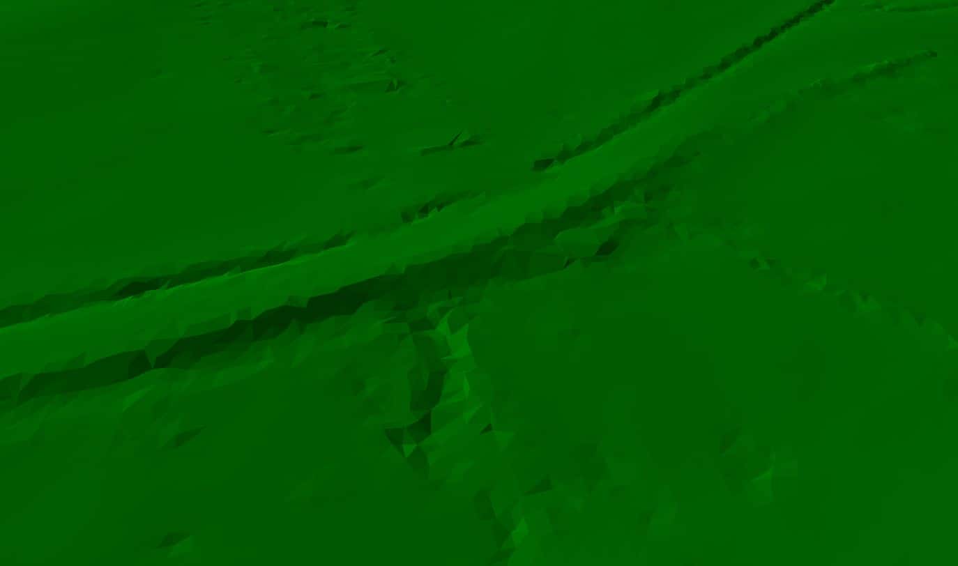
Digital Terrain Model of a road from LiDAR data. The irregular shape of the road is due to random points near changes of grade. Conventional surveys have discrete points with breaklines.

Comparison between modelling by conventional survey techniques and LiDAR. Note the smooth appearance of the road in the foreground from conventional survey. LiDAR data appears at the top of the image, merged into the model.
Doherty Smith & Associates have extensively ground-truthed LiDAR data supplied by Land and Property Information NSW, with excellent results. When comparing measurements taken on a hard, flat surface such as a concrete pad or a road, LiDAR data has consistently been checked to be within 20mm for height of measurements taken by conventional survey methods such as total station or GPS (GNSS). This result exceeds the specifications generally given for LiDAR measurements and gives the user confidence when manipulating LiDAR data.
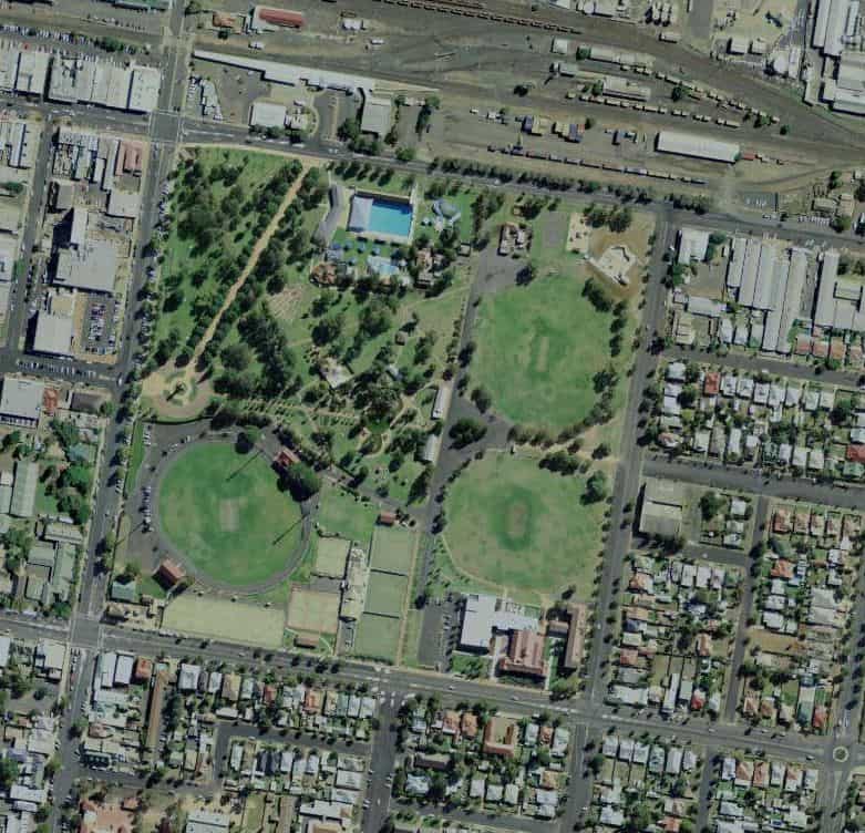
Victoria Park Dubbo, imagery from LPI SIX viewer (http://maps.six.nsw.gov.au/)
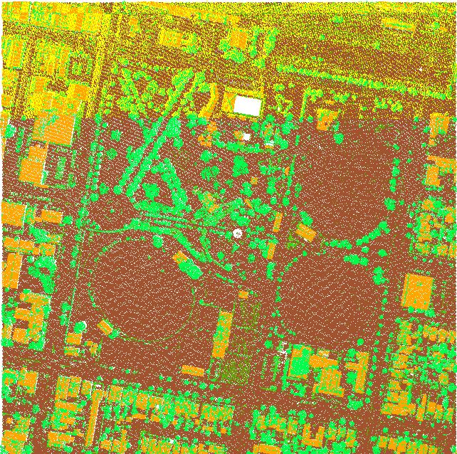
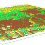
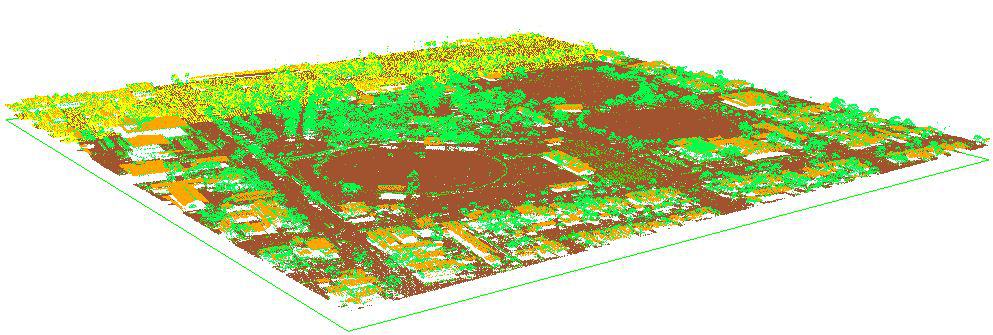
LiDAR data for Victoria Park Dubbo. Vegetation shows as green, buildings show as orange, ground measurements show as brown. Note the pool shows as white, which signifies no measurements.
LiDAR orthographic view of Victoria Park, Dubbo. Vegetation shows as green, buildings as orange, ground measurements as brown.
One of the difficulties in dealing with LiDAR data is the large size of data files due to the large number of points captured. A single tile of two square kilometres will contain about 2 million individual points. The data package for the Dubbo (NSW) area consists of 86 tiles, giving a total of about 1,720 million points. This requires the data to be filtered and thinned, to remove measurements taken on buildings and vegetation and to reduce the density of points.
The use of LiDAR data allows surveyors to model large areas and is becoming a larger part of surveying. Surveying equipment manufacturers are now including scanning features in their total stations, allowing scanning of small scale objects and features. Laser scanning equipment is becoming less expensive and the data processing is being simplified. Ground scanning is becoming more accessible and cost effective, and is likely to become a significant part of surveying in the future.
Eric Smith
Registered Surveyor